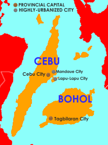
Central Visayas (Cebuano: Tunga-tungang Kabisay-an; Tagalog: Gitnang Kabisayaan or Filipino: Gitnang Visayas) is an administrative region in the Philippines, numerically designated as Region VII. With only two provinces: Cebu and Bohol, as well as three highly urbanized cities: Cebu City, Lapu-Lapu, and Mandaue, it has the fewest number of provinces out of any region in the country. Despite this, it is the most populous region in the Visayas, with a population of 6,545,603.
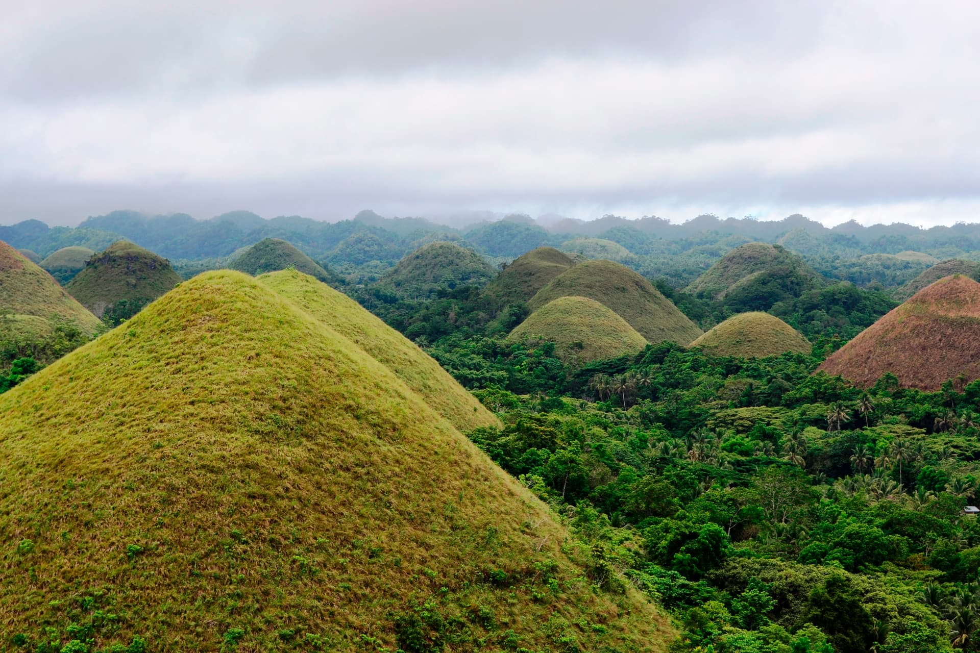
The Chocolate Hills, a famous tourist attraction in Bohol (Hannah Tessa Obedencio - CC BY-SA 4.0, Wikimedia)
The regional center, as well as its largest city, is Cebu City. The Cebuano language is the region’s lingua franca. The region is also dominated by the native speakers of three Visayan languages: Bantayanon, Boholano and Porohanon.
In 2015, Central Visayas was redefined when it lost the province of Negros Oriental to the newly formed Negros Island Region. However, the Negros Island Region was dissolved in 2017, returning Negros Oriental to Central Visayas. After seven years, it lost Negros Oriental again, as well as the island province of Siquijor, after the Negros Island Region was re-established in 2024.
Etymology
The name of the region, Central Visayas, was mostly chosen by American colonists to denote the centrality of the islands within the bigger Visayas area.
There have been proposals to rename the current Central Visayas region, which is dominated by the Cebuano (Sugbuanon) ethnic group, to Sugbu, the former name of the region prior to Spanish colonization in the 16th century. The name refers to the former kingdom of the region, the Rajahnate of Cebu, or Sugbu in Cebuano.
History
Regions first came into existence on September 24, 1972, when the provinces of the Philippines were organized into 11 regions by Presidential Decree No. 1 as part of the Integrated Reorganization Plan by President Ferdinand Marcos Sr. The provinces of Cebu, Bohol, and Negros Oriental (including its then-subprovince of Siquijor) were grouped together to form the Central Visayas region.
By virtue of Executive Order No. 183, s. 2015, issued on May 29, 2015, by President Benigno Aquino III, moved Negros Oriental to the newly formed Negros Island Region.
On August 9, 2017, President Rodrigo Duterte dissolved the Negros Island Region, revoking Executive Order No. 183, s. 2015 through the signing of Executive Order No. 38. This returned Negros Oriental to Central Visayas.
In 2024, Negros Oriental was again moved to the re-established Negros Island Region. Siquijor was also moved to the NIR through Republic Act No. 12000 signed by President Bongbong Marcos.
Geography
Political map of Central Visayas (since June 2024) (CryingSulfur - CC0, Wikimedia)
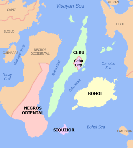
Central Visayas consists of the island provinces of Cebu and Bohol, as well as the three independent cities of Cebu City, Lapu-Lapu City, and Mandaue City. The region also includes the straits of Cebu and parts of the Tañon Strait. Its land area is 10,144.52 km2 (3,916.82 sq mi), 3.3% of the country’s total land area.
Central Visayas is bounded on the north by the Visayan Sea, west by the provinces of Negros Occidental and Negros Oriental in Negros) island, south by the Bohol Sea and the province of Siquijor, and east by the Camotes Sea and the island of Leyte) in Eastern Visayas.
Administrative divisions
Former map of Central Visayas prior to the revival of Negros Island Region in June 2024 (By Namayan - CC BY 2.5, Wikimedia)
Provinces
Central Visayas consists of 2 provinces, 3 highly urbanized cities, 7 component cities, 91 municipalities, and 2,312 barangays.
| Province or HUC | Capital | Population (2020) | Area (km2) | Density (/km2) | Cities | Muni. | Barangay |
|---|---|---|---|---|---|---|---|
| Bohol | Tagbilaran | 21.3% 1,394,329 | 4,772.52 | 290 | 1 | 47 | 1,109 |
| Cebu | Cebu City | 50.8% 3,325,385 | 4,943.72 | 670 | 6 | 44 | 1,066 |
| Cebu City † | — | 14.7% 964,169 | 315.00 | 3,100 | — | — | 80 |
| Lapu-Lapu † | — | 7.6% 497,604 | 58.10 | 8,600 | — | — | 30 |
| Mandaue † | — | 5.6% 364,116 | 25.18 | 14,500 | — | — | 27 |
| Total | 6,545,603 | 10,114.52 | 650 | 10 | 91 | 2,312 |
† Cebu City, Mandaue, and Lapu-Lapu are highly urbanized cities; figures are excluded from Cebu.
† Regional center
Cities
| City | Population (2020) | Area (km2) | Density (/kms2) | City class | Income class | Province |
|---|---|---|---|---|---|---|
| Bogo | 88,867 | 103.52 | 860 | Component | 6th | Cebu |
| Carcar | 136,453 | 116.78 | 1,200 | Component | 5th | Cebu |
| † Cebu City | 964,169 | 315.00 | 3,100 | Highly urbanized | 1st | Cebu |
| Danao | 156,321 | 107.30 | 1,500 | Component | 3rd | Cebu |
| Lapu-Lapu | 497,604 | 58.10 | 8,600 | Highly urbanized | 1st | Cebu |
| Mandaue | 364,116 | 25.18 | 14,000 | Highly urbanized | 1st | Cebu |
| Naga | 133,184 | 101.97 | 1,300 | Component | 3rd | Cebu |
| Tagbilaran | 104,976 | 36.50 | 2,900 | Component | 3rd | Bohol |
| Talisay | 263,048 | 39.87 | 6,800 | Component | 3rd | Cebu |
| Toledo | 207,314 | 216.28 | 960 | Component | 3rd | Cebu |
Demographics
Population of Central Visayas from 1903 to present
| Year | Pop. | ±% p.a. |
|---|---|---|
| 1903 | 1,124,444 | — |
| 1918 | 1,485,976 | +1.88% |
| 1939 | 1,954,366 | +1.31% |
| 1948 | 2,119,975 | +0.91% |
| 1960 | 2,522,802 | +1.46% |
| 1970 | 3,032,719 | +1.86% |
| 1975 | 3,387,274 | +2.24% |
| 1980 | 3,787,374 | +2.26% |
| 1990 | 4,594,124 | +1.95% |
| 1995 | 5,014,588 | +1.65% |
| 2000 | 5,706,953 | +2.81% |
| 2007 | 6,400,698 | +1.59% |
| 2010 | 6,800,180 | +2.23% |
| 2015 | 7,396,898 | +1.61% |
| 2020 | 8,081,988 | +1.76% |
Data in 2015 includes Negros Oriental. Data in 2020 includes Negros Oriental and Siquijor. (Source: Philippine Statistics Authority)
According to the 2020 census, it has a population of 6,545,603. Before Negros Oriental and Siquijor separated from the region in 2024, it was 8,081,988.
The population density was 510/km2 (1,300/sq mi). The 2015 census showed an average annual population growth rate of 1.76% from 2010 to 2015, slightly higher than the national average of 1.72%.
Languages
The native languages of Central Visayas are:
- Bantayanon, spoken in Bantayan Island of Cebu.
- Boholano, a Cebuano dialect spoken in Bohol.
- Cebuano, spoken in Cebu and Bohol. It is the regional lingua franca.
- Porohanon, spoken in Camotes Islands of Cebu.
Economy
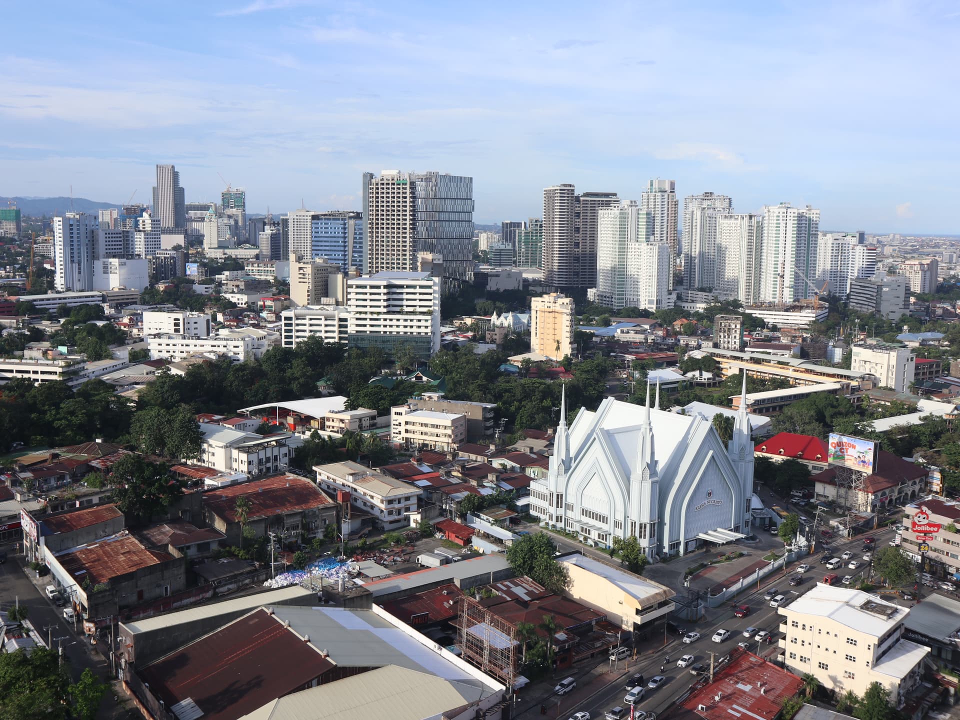
A skyline view of Cebu City (Patrickroque01 - CC BY-SA 4.0, Wikimedia)
Poverty incidence of Central Visayas
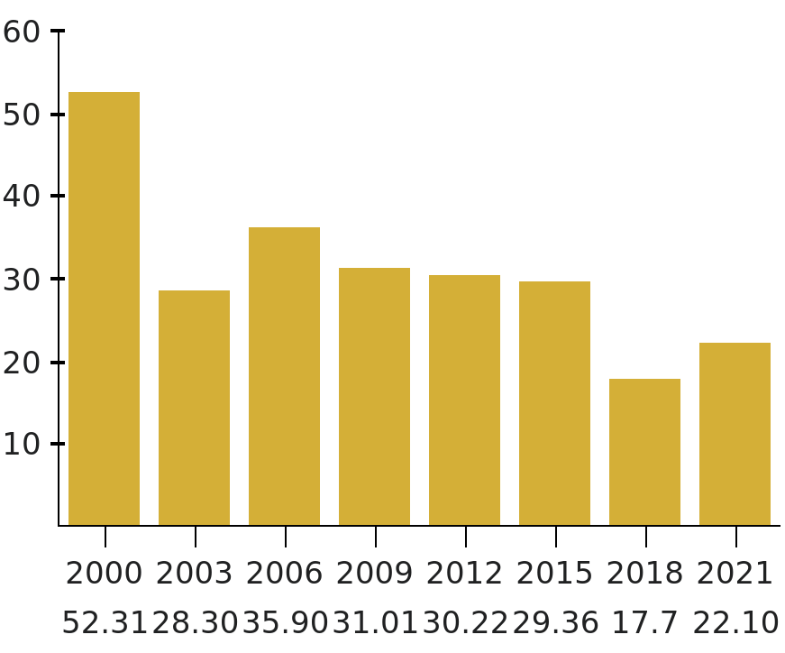
Source: Philippine Statistics Authority
Central Visayas has the fourth-largest economy in the Philippines. Cebu City serves as the region’s economic hub.
Transportaion
Ports
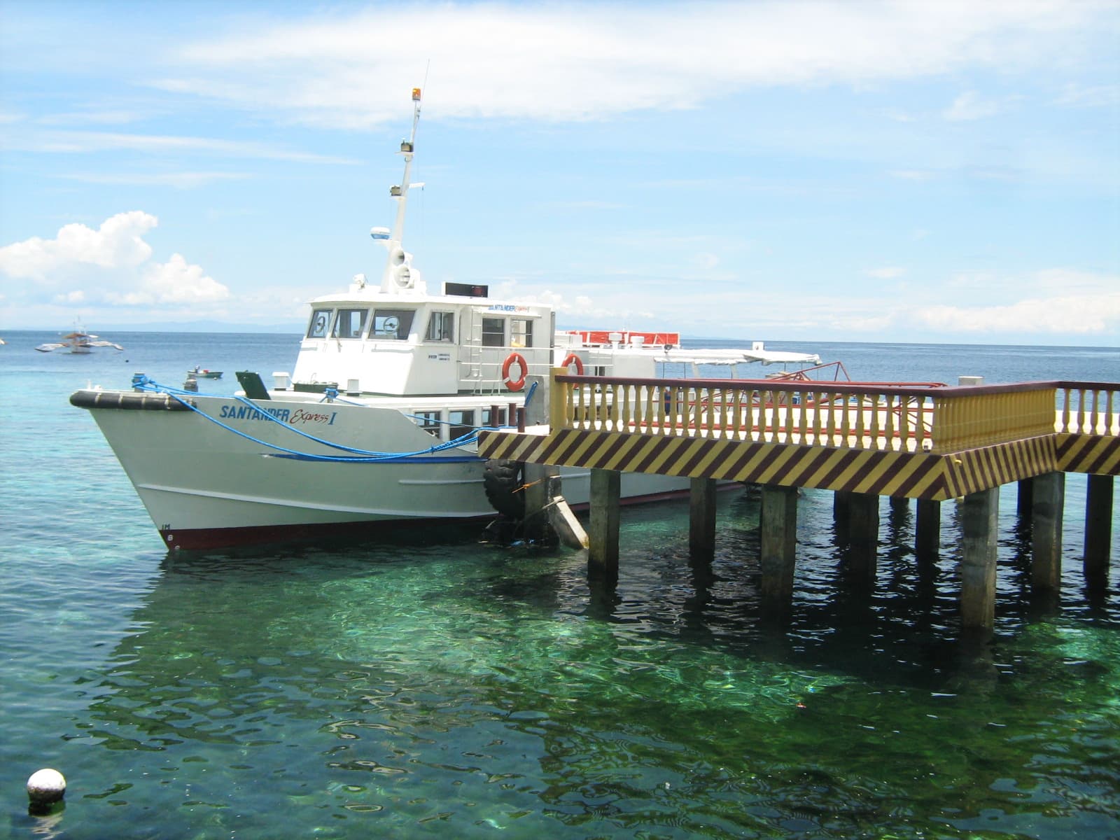
Fastcraft terminal for ferrying passengers from Cebu to Negros Island (By Mike Gonzalez (TheCoffee) - CC BY-SA 3.0, Wikimedia)
The Port of Cebu is the region’s main gateway by sea. Other seaports in the region include the Liloan Port in Santander, Cebu and the Port of Tagbilaran in Bohol. Inter-island shipping is served by numerous shipping lines, including ro-ro companies Montenegro Lines and Lite Ferries and fastcraft companies OceanJet and Supercat.
Airport
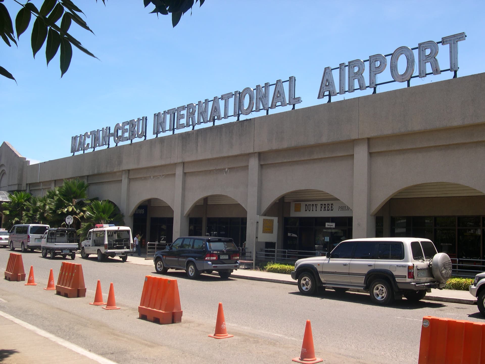
Mactan–Cebu International Airport (Magalhães - Public Domain, Wikimedia)
Mactan–Cebu International Airport, located on Mactan Island in Metro Cebu, is the country’s second-busiest airport and a gateway to the region by air. It is the secondary hub of Cebu Pacific and Philippine Airlines (and their subsidiaries), with flights to locations throughout the country. It also serves international flights to other Asian and intercontinental destinations.
Bohol–Panglao International Airport serves Bohol and is the region’s newest airport.
Mass media
Cebu City is the main media hub for the region. Large media networks – ABS-CBN, GMA Network, TV5), People’s Television Network, CNN Philippines, and IBC 13 – maintain their respective local stations and branches for viewership, commercial and news coverage purposes. Most of these stations broadcast local news and public affairs as well as entertainment and dramas to cater to the local viewers.
Aside from the 24 national daily newspapers available, Cebu City also has 20 local newspapers. Among the widely read are SunStar Cebu, Cebu Daily News, and The Freeman).
Content by Wikipedia contributors (CC BY-SA 4.0)